jQuery Geocoding and Places Autocomplete with Google Maps API - geocomplete
| File Size: | 30.5 KB |
|---|---|
| Views Total: | 45975 |
| Last Update: | |
| Publish Date: | |
| Official Website: | Go to website |
| License: | MIT |
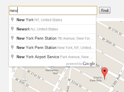
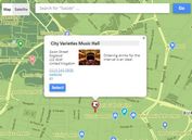
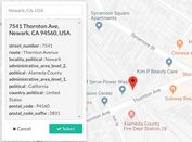
geocomplete is a powerful jQuery javascript that provides Geocoding and Places Autocomplete functionalities for your input fields based on Google Maps API's Geocoding Service and Places Library. Optionally add a container to show an interactive map and a form that will be populated with the address details.
⚠️ THE PLUGIN IS NOT MAINTAINED. Use the Easy Google Address/Place Autocomplete Plugin Instead.
Basic Usage:
1. Create an address input filed with a autocomplete dropdown list.
<input id="geocomplete" type="text" placeholder="Type in an address" />
2. Include required Google Maps Javascript API on your web page.
<script src="http://maps.googleapis.com/maps/api/js?sensor=false&libraries=places"></script>
3. Include the latest jQuery javascript library and jQuery geocomplete plugin on your web page.
<script src="http://ajax.googleapis.com/ajax/libs/jquery/1.10.2/jquery.min.js"></script>
<script src="../jquery.geocomplete.js"></script>
4. Call the plugin.
<script>
$(function(){
$("#geocomplete").geocomplete()
});
</script>
5. Options.
- 'map' - Might be a selector, an jQuery object or a DOM element. Default is 'false' which shows no map.
- 'details' - The container that should be populated with data. Defaults to 'false' which ignores the setting.
- 'location' - Location to initialize the map on. Might be an address 'string' or an 'array' with [latitude, longitude] or a 'google.maps.LatLng'object. Default is 'false' which shows a blank map.
- 'bounds' - Whether to snap geocode search to map bounds. Default: 'true' if false search globally. Alternatively pass a custom 'LatLngBounds object.
- 'detailsAttribute' - The attribute's name to use as an indicator. Default: '"name"'
- 'mapOptions' - Options to pass to the 'google.maps.Map' constructor. See the full list [here]
- 'mapOptions.zoom' - The inital zoom level. Default: '14'
- 'mapOptions.scrollwheel' - Whether to enable the scrollwheel to zoom the map. Default: 'false'
- 'mapOptions.mapTypeId' - The map type. Default: '"roadmap"'
- 'markerOptions' - The options to pass to the 'google.maps.Marker' constructor. See the full list [here].
- 'markerOptions.draggable' - If the marker is draggable. Default: 'false'. Set to true to enable dragging.
- 'markerOptions.disabled' - Do not show marker. Default: 'false'. Set to true to disable marker.
- 'maxZoom' - The maximum zoom level too zoom in after a geocoding response. Default: '16'
- 'types' - An array containing one or more of the supported types for the places request. Default: '['geocode']' See the full list [here]
Check the examples for more usages:
- Simple - Single input with an event logger.
- Map - Adding a map.
- Location - Adding a default location.
- Form - Populate form fields.
- Attribute - Using custom attributes to populate data.
- Multiple results - Handling multiple results from the geocoder.
- Draggable - A draggable marker to redefine the position.
- API - API Example.
- Bounds - Bounds example.
- Contry Limits - Contry Limits example.
Change logs:
2017-06-30
- Support strictBounds parameter for places autocomplete
2016-04-13
- v1.7
2015-06-18
- Allow support for multiple geocomplete form fields on one page
2015-05-30
- Adding `geocode:mapdragged` event support
2015-05-06
- Don't trigger a geocode request if the address input is empty
2015-03-09
- v1.6.5
2014-11-07
- Revert "Trigger event when no results are found"
2014-10-31
- Trigger event when no results are found
2014-10-14
- Cycle through subtypes in address components.
- Add "place_id" to places details.
- Avoid exception if getPlace() returns undefined
2014-08-29
- Updated to v1.6.3
2014-08-22
- Add "place_id" to places details.
2013-12-20
- Fixed keep result at text input after focusout.
This awesome jQuery plugin is developed by ubilabs. For more Advanced Usages, please check the demo page or visit the official website.
