jQuery Plugin To Add Markers & Info Windows On Google Maps - AxGmap
| File Size: | 6.49 KB |
|---|---|
| Views Total: | 3512 |
| Last Update: | |
| Publish Date: | |
| Official Website: | Go to website |
| License: | MIT |
AxGmap is a lightweight Google Maps V3 jQuery plugin to create customizable map markers and info windows using Html5 data-* attributes.
How to use it:
1. Include the Google Maps JavaScript API V3 on your webpage.
<script src="https://maps.google.com/maps/api/js?sensor=false"></script>
2. Include jQuery library and the jQuery AxGmap plugin on the page.
<script src="//code.jquery.com/jquery-1.11.1.min.js"></script>
<script src="jquery.axgmap.js"></script>
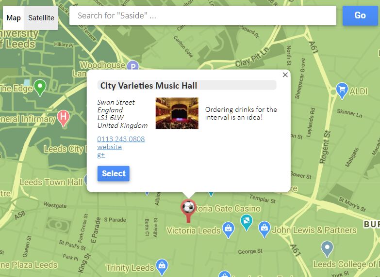
3. Embed Google Maps with custom markers into your document.
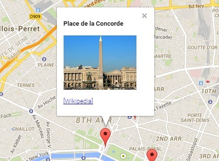
<div class="axgmap" data-latlng="48.868974, 2.330663" data-zoom="13">
  <p data-latlng="48.860617, 2.337650" data-title="Louvre Museum">Louvre Museum</p>
  <p data-latlng="48.865491, 2.321137" data-title="Place de la Concorde">Place de la Concorde</p>
  <p data-latlng="48.871977, 2.331612" data-title="Palais Garnier">Palais Garnier</p>
</div>
4. Adding the marker and info window.
<div class="axgmap" data-latlng="48.868974, 2.330663" data-zoom="13">
  <div data-latlng="48.860617, 2.337650" data-title="Louvre Museum" data-window-open="true">
    <h4>Louvre Museum</h4>
    <p><img src="1.jpg" width="150"></p>
    <p><a href="http://en.wikipedia.org/wiki/Louvre">[Wikipedia]</a></p>
  </div>
  <div data-latlng="48.865491, 2.321137" data-title="Place de la Concorde">
    <h4>Place de la Concorde</h4>
    <p><img src="2.jpg" width="150"></p>
    <p><a href="http://en.wikipedia.org/wiki/Place_de_la_Concorde">[Wikipedia]</a></p>
  </div>
  <div data-latlng="48.871977, 2.331612" data-title="Palais Garnier">
    <h4>Palais Garnier</h4>
    <p><img src="3.jpg" width="150"></p>
    <p><a href="http://en.wikipedia.org/wiki/Palais_Garnier">[Wikipedia]</a></p>
  </div>
</div>
5. Full data-* options for the Google Maps.
data-latlng: The initial Map center.data-map-width: Map width (px).data-map-height: Map Height (px).data-zoom: The initial Map zoom level.data-max-zoom: The maximum zoom level.data-min-zoom: The minimum zoom level.data-map-type: The initial Map mapType. (HYBRID | ROADMAP | SATELLITE | TERRAINDefaults to ROADMAP.)data-draggable: If false, prevents the map from being dragged.data-scrollwheel: If false, disables scrollwheel zooming on the map.data-map-status: If true, show map status.data-map-type-control: The initial enabled/disabled state of the Map type control.data-overview-map-control: The enabled/disabled state of the Overview Map control.data-pan-control: The enabled/disabled state of the Pan control.data-rotate-control: The enabled/disabled state of the Rotate control.data-scale-control: The initial enabled/disabled state of the Scale control.data-street-view-control: The initial enabled/disabled state of the Street View Pegman control.data-zoom-control: The enabled/disabled state of the Zoom control.
6. Full data-* options for map markers.
data-latlng: Marker position. Defaults to Map center.data-title: Rollover text.data-window-open: If true, initial opened the info window.data-marker-image: The URL of the marker image.
This awesome jQuery plugin is developed by Nouris-Inc. For more Advanced Usages, please check the demo page or visit the official website.